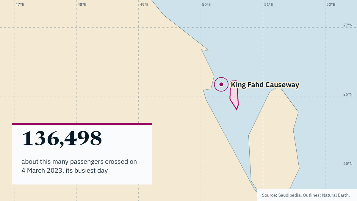
The King Fahd Causeway is a sea bridge across the Gulf that links Saudi Arabia and Bahrain, running from Aziziyah south of al-Khobar to al-Jasra west of Manama. Its busiest recorded day came on 4 March 2023, when about 136,498 passengers crossed, 36 years after it opened.
Key points
- The King Fahd Causeway is a sea bridge across the Gulf between Saudi Arabia and Bahrain.
- It runs from Aziziyah south of al-Khobar to al-Jasra west of Manama.
- Passport Island sits on embankment No. 4 in the middle, about 660,000 square meters split between a Saudi western side and a Bahraini eastern side.
- Building it cost SAR 3.013 billion, including supervision, embankments, terminals and border buildings.
- Its busiest recorded day was 4 March 2023, with about 136,498 passengers, 36 years after it opened.
What the King Fahd Causeway is
The King Fahd Causeway is a sea bridge across the Gulf that joins Saudi Arabia and Bahrain. According to Saudipedia, it runs from Aziziyah, south of al-Khobar on the Saudi side, to al-Jasra, west of Manama on the Bahraini side.
A sea bridge of this kind carries road traffic over open water rather than over a river or a narrow strait. For readers new to the region, the point to hold on to is simple: the causeway is a fixed road link between an island state and the mainland, and traffic crosses a border in the middle of the water.
The crossing is not a single uninterrupted span. It is built in parts, with embankments — raised banks of fill — carrying the road between bridge sections. One of those embankments holds the border facilities, which is why the middle of the causeway is a place in its own right and not just a stretch of asphalt.
That shape has a practical effect. A driver does not simply join a motorway and stay on it until the far shore. The route is a sequence of road, embankment and bridge, and the middle of that sequence is where the paperwork happens. The causeway is therefore best understood as a corridor with a checkpoint built into it, not as a single bridge in the ordinary sense.
Passport Island: the border in the middle of the sea
Passport Island sits on embankment No. 4, roughly halfway along the causeway, according to Saudipedia. It covers about 660,000 square meters and is split into two parts: a Saudi western side and a Bahraini eastern side.
The arrangement means travellers clear immigration and customs on an artificial island rather than at either end of the bridge. Each state handles its own side of the island, so the crossing has two border posts within one compact footprint.
For a driver, the sequence is: leave one country’s road network, cross water, stop on the island for border checks, then continue over more water into the other country. The island is the hinge of the whole route. Without it, the causeway would need separate terminal complexes on each shore and the road would function differently.
The split also tells you something about how the two states share the crossing. The border is not at a shoreline where one country’s officials hand over to the other’s. It sits in open water on ground that belongs to the link itself, with each side running its own checks. That is an unusual arrangement for a road border.
What it cost to build
Building the causeway cost SAR 3.013 billion, a figure that includes supervision, embankments, terminals and border buildings, Saudipedia reports. The breakdown matters as much as the total: the money went into the marine works that carry the road, the buildings where border business happens, and the oversight of the project, not only into bridge decking.
One reading is that the cost profile reflects how much of a causeway is invisible from a car window. Embankments, terminals and border buildings are the parts that make a sea crossing usable at scale.
This is interpretation, not a figure from the source: a fixed link of this kind is usually judged on throughput and on how well the border island handles peaks, because those are the constraints a driver actually feels. The source gives the total and what it covers, and it does not break the sum down further. Readers should treat SAR 3.013 billion as the reported cost of the project as described, not as a current valuation or a maintenance budget.
How busy the crossing gets
The causeway’s busiest recorded day was 4 March 2023, when about 136,498 passengers crossed, according to Saudipedia. That day came 36 years after the link opened.
The gap is the interesting part. A crossing that was already decades old set its passenger record, which suggests demand kept growing long after the opening. It also suggests the border island and the approach roads carry a load their planners did not see at the start.
Passenger counts and vehicle counts are different measures, and the source gives the passenger figure for that day. Readers should not read the number as a daily average or as a capacity limit. It is one record day, and the source does not say what the normal flow looks like.
There is a second caution: the figure describes a peak spike, not a baseline. What the number does show is that the link can absorb a very large one-day flow of people, and that the border island is where that flow has to be sorted.
Why it matters and what to watch
The King Fahd Causeway is the fixed road link between Bahrain and the Saudi mainland described by Saudipedia. Because the border sits on Passport Island in the middle of the water, the crossing is both a piece of transport infrastructure and a border facility at once. Congestion at the island is congestion on the whole route.
This suggests the causeway’s importance goes beyond tourism. A road link between an island economy and its largest neighbour shapes how people move for work, family visits and trade by road. The record day of 4 March 2023, with about 136,498 passengers 36 years after opening, points to steady pressure on that link.
What to watch: any change in how the two sides of Passport Island process travellers, since the island is split between a Saudi western side and a Bahraini eastern side. Watch also for new passenger records, which would show demand still climbing. A record set decades after opening is a signal that the link is still gaining users, not settling into a plateau.
What is not known from these facts: current traffic volumes, how the causeway is funded or maintained today, and whether any expansion is planned. Those gaps are worth filling before drawing conclusions about capacity. The source describes the link, its cost and one record day; it does not describe the queue, the toll or the repair schedule. Until those are known, the safest reading is that the causeway is a mature link under visible peak pressure, with the border island as the place where that pressure shows first.